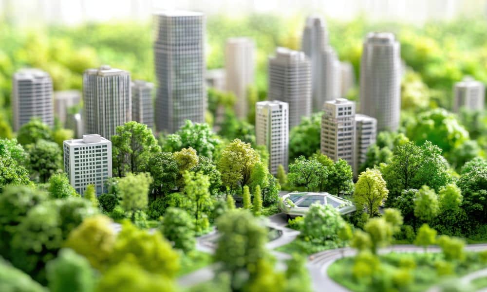
Knoxville keeps growing, and with that growth comes one big problem many people feel each summer: our neighborhoods seem hotter than before. Asphalt, roofs, parking lots, and new construction trap heat and make some areas uncomfortable. That’s why urban planning matters so much today. Civil engineers and developers across Knoxville look for design choices that cool communities, save energy, and create better places for people.
Many cities around the country now study how to reduce heat. A recent science report showed how simple changes in layout, materials, and green spaces can lower temperatures in busy neighborhoods. Even though the study was done in a different climate, the ideas fit Knoxville well. Our summers are warm and humid, so cooling strategies make a real difference. When used early in design, these ideas help create safer, greener, and more pleasant places to live.
Knoxville also keeps spreading outward. Areas like Hardin Valley, Powell, South Waterfront, and North Knoxville see new homes, stores, and road projects every year. Because of this growth, civil engineers guide city leaders and developers on how to design spaces that stay cool without raising energy use. This blend of smart design and simple planning brings comfort to the people who live, walk, and work in these neighborhoods.
Using Better Materials to Reduce Heat
Good design starts with choosing the right materials. Many parking lots and roads use dark asphalt, which soaks up heat all day. At night, the heat stays trapped and warms the air around houses and sidewalks. A better choice is cool pavement, which reflects more sunlight and lowers surface temperature. These lighter surfaces work well in subdivisions, shopping areas, and busy roads.
Permeable pavement also helps because water in the soil cools the ground as it evaporates. Civil engineers often use this material in places like Knoxville, where clay-heavy soil is common.
Roofing choices matter too. A large building in Cedar Bluff or Turkey Creek can create a hot zone if it uses dark roofing. Lighter roofs lower heat buildup and cut cooling costs. Green roofs go even further by adding plants that give shade and help with stormwater. While not every building can use a green roof, many downtown Knoxville projects consider it because it saves money and supports a healthier environment.
Designing Smarter Neighborhood Layouts
Materials help, but layout matters just as much. The way a neighborhood is shaped affects how air moves and how much shade people get while walking. For example, placing streets in a way that avoids direct afternoon sun can make sidewalks cooler. Trees help even more. A single tree can lower surface temperatures by several degrees, and a row of trees creates a shaded walkway that encourages people to spend time outside.
Green spaces also play a major role. Knoxville already has a great greenway system, and civil engineers use it as a model for new projects. These long, shady paths act as cooling corridors. They connect neighborhoods, parks, and shopping areas. Smaller green pockets—like mini-parks or landscaped corners—break up paved areas and help cool the surroundings.
Using Water and Soil to Cool Down Communities

Water is a strong cooling tool. When rain falls on large paved spaces, the water heats up as it runs off the surface. This hot water then flows into storm drains and creeks, which harms local streams. Engineers stop this by designing rain gardens, bioswales, and detention ponds with plants that shade the water and let it cool down naturally. These features both manage stormwater and lower heat, so they give two benefits at once.
Soil matters too. Moist soil cools the air around it, so using the right soil mix during construction helps lower temperatures. This simple step makes a big difference in the hot summer.
A Knoxville Example: Cooling a Busy Corridor
Let’s imagine how this works in a real spot. Think about a busy area like Magnolia Avenue. It has wide roads, big parking lots, and buildings close to the street. In summer, the whole area absorbs heat.
If redesigned with cool pavement, tree-lined sidewalks, shaded bus stops, and small pocket parks, the area would feel much cooler. Civil engineers would adjust grading, drainage, and building placement to support these features. Even small changes, like planting trees on both sides of the street, can improve comfort for everyone who uses the space.
Why Developers and Residents Benefit
Developers gain a lot from heat-resilient design. Homes in cooler neighborhoods often have lower energy bills. Pavements and sidewalks last longer because they face less heat stress. Green streets and shaded spaces raise property values and attract more buyers. Commercial areas get more visitors when people feel comfortable walking outside.
Residents feel the benefits every day. Streets stay safer for families who walk at night. Playgrounds stay cooler during the day. Neighborhoods look cleaner and feel more welcoming. People spend more time outdoors, which builds stronger community ties.
What Civil Engineers Should Do Next
As Knoxville grows, civil engineers should lead early talks with city planners, builders, and developers. Small choices—like where to plant trees, how to align a street, or what pavement to use—create long-term effects. When engineers make these decisions early, projects stay affordable and work better.
Engineers can also offer a “heat-resilience review” during planning. This helps clients understand the value of cooling strategies and how they fit into their project.
Conclusion:
Heat-resilient urban planning shapes how Knoxville grows and how people live day to day. Civil engineers guide these changes with science, design, and practical tools. With the right strategies, Knoxville can stay green, cool, and comfortable—even as summers warm up.
By choosing better materials, smarter layouts, and nature-based solutions, we create neighborhoods that work for everyone. The decisions made today will shape Knoxville for decades.