
When Tennessee receives a federal disaster declaration, most homeowners think about cleanup first. They check the roof, remove fallen branches, and call their insurance agent. That makes sense. The damage feels urgent and visible. However, another process starts at the same time — and many owners don’t see it coming. Behind the scenes, FEMA, lenders, and local building offices begin reviewing affected properties. They don’t just look at damage. They also look at risk, structure data, and flood compliance. Because of that, many property owners suddenly get asked for one specific document: a FEMA elevation certificate.
Disaster Declarations Trigger More Than Emergency Funding
A disaster declaration does not only release aid money. It also activates review systems across several agencies. FEMA opens case files. Insurance carriers rerun risk models. Meanwhile, lenders review loans in impacted ZIP codes. Local permit offices also take a closer look at damaged structures.
As a result, properties near flood-prone areas often move to the top of review lists. That does not mean the property flooded. Instead, it means the location falls inside a higher-risk zone after the event.
Because reviewers cannot visit every site right away, they rely on verified data. They want measurements, not estimates. Therefore, elevation records suddenly become very important.
FEMA Decisions Depend on Structure Height — Not Just Damage Photos

After storms, homeowners often submit photos and written descriptions. Those help tell the story. However, FEMA reviewers still need technical numbers. They compare water levels to the lowest finished floor of the structure. That comparison affects aid decisions and compliance steps.
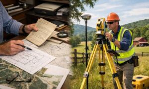
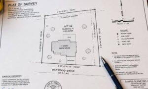
Here’s where a FEMA elevation certificate comes in. A licensed surveyor prepares this document using field measurements. It shows exactly how high the building sits compared to official flood reference levels.
Without that certificate, reviewers must guess or request more documents. That slows the process. On the other hand, certified elevation data answers the question immediately. Clear numbers move files forward faster.
Repair vs Rebuild Rules Can Change After Major Damage
Many homeowners expect to repair storm damage and move on. Sometimes that happens. However, disaster rules include a threshold called “substantial damage.” When repair costs pass a certain percentage of the building’s value, different rules apply.
At that point, officials may require the structure to meet current floodplain standards before rebuild approval. That can include elevation requirements. Naturally, this surprises many owners because nobody mentioned it before the storm.
So how do officials decide which path applies? They look at both damage level and structure elevation. A FEMA elevation certificate gives them verified height data. Consequently, it plays a direct role in what repair options remain available.
That makes the certificate more than paperwork. It becomes part of the rebuild decision itself.
When Reviewers Disagree, Certified Elevation Data Wins
After disasters, not every report matches. One inspector may record a certain flood depth. Another reviewer may question that number. Insurance adjusters, FEMA reviewers, and local officials sometimes see the same property differently.
That creates stress and delays. However, certified elevation measurements often settle the disagreement. A FEMA elevation certificate uses standard methods and federal forms. Because of that, agencies trust the numbers.
Instead of debating water marks or guesswork, reviewers compare measured elevations. That shifts the conversation from opinion to proof. In many cases, that alone clears the issue.
Permit Offices Often Ask New Questions After Disaster Events
Many people associate elevation certificates with new construction. Yet post-disaster permits often trigger elevation checks too. When owners apply for major repair or rebuild permits, reviewers want to confirm flood compliance.
For example, foundation repairs or structural rebuilds often lead to closer review. Permit staff may request elevation verification before approval. If records look incomplete, they may ask for a FEMA elevation certificate.
This step protects both the owner and the community. It ensures rebuilt structures meet safety rules going forward. Still, it can delay work when documentation is missing. Early elevation verification helps avoid that surprise.
Demand Spikes After Declarations — Timing Matters
Right after a disaster declaration, documentation requests increase across the region. Many owners receive letters and emails within the same few weeks. At the same time, surveyors receive more calls for elevation work.
Because field surveys take time, schedules fill quickly. Therefore, waiting until a deadline appears can create delays. Claims, permits, and aid reviews may pause while owners gather documents.
On the other hand, early action keeps files moving. When elevation data already exists, reviewers can continue without interruption. That timing difference often reduces stress during recovery.
Some Owners Already Have the Document — They Just Don’t Know It
Here’s the good news. Not every request means new field work. Some properties already have a FEMA elevation certificate from a past closing or construction project. Owners often forget because years passed since the document was created.
So it makes sense to check old records first. Closing folders, builder packets, and prior survey files often contain elevation documents. If the structure and site grade have not changed, reviewers may still accept that certificate.
However, additions or foundation changes usually require updates. Still, checking first can save both time and cost.
Why This One Document Carries So Much Weight
After Tennessee’s latest disaster declaration, agencies rely on verified facts. They need consistent measurements to make fair decisions. A FEMA elevation certificate provides that consistency.
It supports aid reviews, permit approvals, and rebuild decisions. Just as important, it reduces arguments and delays. Instead of guessing, reviewers can rely on certified data.
Storm recovery already feels stressful. Clear documentation removes one major unknown. And when decisions depend on elevation, measured proof makes all the difference.