LiDAR Mapping in the AI Era: Faster, Smarter Site Data
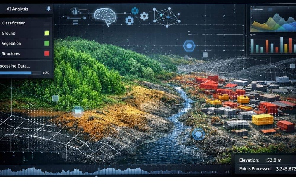
Most people think lidar mapping simply means scanning land with lasers and turning it into a 3D model. For many years, that description worked. However, the biggest change today is not in how data gets captured — it’s in how data gets understood. Lidar mapping has started moving into the AI era. That shift changes […]
Why Elevation Certificate Requests Spike After Storms

After a big storm hits Knoxville, most homeowners focus on the obvious things first. They check the roof, look for leaks, and clear fallen branches. However, many don’t realize that another type of inspection often starts quietly in the background. Lenders and insurance companies begin property risk reviews — and those reviews often start with […]
New ALTA Land Survey Updates Are Catching Buyers Off Guard

A lot of commercial property buyers expect the survey step to be simple. Order the survey, wait a bit, receive the map, move toward closing. However, many deals this month are hitting a snag at exactly that point — the ALTA land survey. Closings that looked ready are getting pushed. Lenders are sending surveys back […]