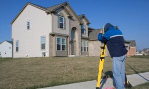
Property development in Clarksville TN often faces barriers tied to zoning restrictions and shared access. These issues delay projects and increase costs when not addressed early. An ALTA survey offers verified data that helps solve these challenges.
Navigating Zoning Restrictions in Clarksville’s Expanding Areas
Zoning regulations across Clarksville define how land can be used. These rules vary between neighborhoods and may include:
- Land use restrictions
- Setback distances from property lines
- Height and density controls
When design teams overlook zoning limits early, the result is delays and redesigns. ALTA surveys help avoid this by showing property boundaries and access rights before planning begins. This allows teams to match the site’s real conditions with zoning expectations.
Shared Access and Limited Frontage on Commercial Parcels
In many commercial zones, parcels may lack direct road frontage or share driveways with neighboring sites. These conditions create legal and design challenges.
ALTA surveys provide clear boundary and access verification, documenting:
- Recorded access easements
- Legal right-of-way routes
- Frontage details affecting entry and exit
This verified data helps layout access points that meet both legal and zoning requirements. It also reduces disputes over who has the right to use certain driveways or pathways.
Identifying Design Triggers in Local Zoning Codes
Zoning codes may include overlays, buffers, and site-specific limitations. These elements can affect the shape, location, and size of new structures.
By surveying for zoning compliance using ALTA data, planners can:
- Check setback areas
- Identify restricted building zones
- Align site layout with code-mandated features
This prevents conflicts between proposed designs and zoning triggers, especially in areas with corridor or overlay districts.
Coordinating Title and Zoning in Mixed-Use or Special Use Areas
Some parcels in Clarksville fall under conditional or mixed-use zoning. In these cases, the legal use of the land depends on both title conditions and local zoning approval.
ALTA surveys help verify:
- Parcel boundaries for multiple zoning types
- Recorded restrictions that affect building use
- Legal documents that impact zoning interpretation
By comparing these details with planning codes, teams avoid proposing designs that conflict with permitted land uses.
Aligning Layout and Boundaries for Functional Site Use
Even small errors in boundary interpretation can lead to building misplacement or utility conflicts. ALTA surveys reduce this risk by providing exact data on:
- Property lines
- Existing encroachments
- Adjacent rights-of-way
This helps designers place buildings, driveways, and utility lines without crossing into restricted or off-limit zones. It also creates space for zoning-required features like buffers or drainage corridors.
Permitting Support Through Early Survey Integration
City and county permit approvals depend on accurate, verifiable documents. When ALTA survey data is integrated early, it supports faster and cleaner submissions.
Benefits include:
- Fewer revisions during planning review
- Clear alignment with land use rules
- Easier coordination with site engineers and inspectors
By showing legal conditions upfront, projects stay on schedule and reduce risk of rejection.
Where Zoning and Access Problems Most Often Occur
Zoning and access complications are common in several project types:
- Commercial pads with narrow frontage or rear access
- Multi-family housing in special-use or density-controlled areas
- Urban sites that include shared walls or split parcels
In each case, ALTA surveys provide the documentation needed to move forward with confidence.
FAQs
1. What zoning problems can an ALTA survey help solve?
It helps identify setbacks, overlays, and boundary conflicts that may block approvals.
2. How does an ALTA survey support legal access planning?
It shows rights-of-way, easements, and shared driveway agreements tied to the property.
3. Is ALTA survey data required for permitting?
It’s not always required, but it helps speed up approvals and avoid redesigns.
4. What types of projects benefit most in Clarksville?
Sites in commercial corridors, infill zones, and mixed-use areas benefit the most.
5. Who uses the survey data during development?
Planners, civil engineers, legal teams, and review boards rely on ALTA survey data for decision-making.


