LiDAR mapping is helping Chattanooga, TN grow into one of the most modern cities in the Southeast. Known for its beautiful scenery and creative energy, the city is now leading the way in smart urban development. In 2025, new projects are changing neighborhoods across Chattanooga—and LiDAR is playing a big role behind the scenes.
It’s not just about money or big plans. Technology like LiDAR mapping is giving city leaders better tools to build safer streets, improve infrastructure, and plan for the future in a smarter, more sustainable way.
The Role of Technology in Urban Redevelopment
Chattanooga has been at the forefront of smart city initiatives for over a decade. Known as “Gig City” thanks to its early adoption of high-speed fiber internet, the city has consistently embraced innovation to improve the lives of its residents.
Now, that same forward momentum is being applied to redevelopment efforts. From the Southside to the riverfront, new construction is guided not just by vision, but by data. LiDAR is one of the key tools city planners and engineers use to understand the physical landscape, spot challenges early, and design spaces that serve the community well.
Technology is no longer just a bonus in city planning—it’s the foundation. And in Chattanooga, it’s being used wisely.
How Chattanooga is Applying LiDAR in Urban Projects
So, how exactly is LiDAR Mapping in Chattanooga, TN being used? Let’s look at a few real-world examples.
Downtown and Southside Redevelopment
Chattanooga’s Southside has evolved rapidly, becoming one of the city’s most vibrant districts. As redevelopment continues, LiDAR plays a behind-the-scenes role in surveying the land, locating utilities, and ensuring that construction won’t interfere with underground infrastructure.
Downtown projects use LiDAR data to create accurate 3D models of the landscape, helping architects and planners decide where to build, how high, and how to optimize space. This is especially helpful in preserving the city’s character while modernizing key areas.
Infrastructure Upgrades and Utility Planning
Chattanooga is also investing in its core infrastructure—from storm drains to broadband. Accurate mapping is essential, especially in densely built areas. With LiDAR, engineers can detect slopes, hidden obstacles, and outdated infrastructure that needs replacement before a shovel hits the ground.
It’s not just about efficiency—it’s about safety, long-term savings, and smart use of public funds.
Traffic and Transportation Improvements
As the city grows, so does traffic. LiDAR data is helping transportation officials map out smarter traffic patterns, improve road alignments, and identify areas where pedestrian walkways or bike lanes are most needed.
Instead of relying solely on traffic counts or manual surveys, planners can now analyze real-world data in 3D.
Precision Planning with Land Surveying and LiDAR Integration
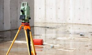
At its core, LiDAR mapping works hand-in-hand with land surveying. Traditional surveys are still vital, but when paired with LiDAR data, they become far more powerful.
Chattanooga’s development teams are using this combination to:
- Create accurate terrain models for construction
- Identify potential flood zones and drainage paths
- Support zoning applications with hard data
- Make design decisions faster with fewer surprises
This approach saves both time and money—two things no project can afford to waste.
For companies and city departments alike, it means fewer delays, fewer change orders, and smoother collaboration across teams.
Environmental Protection and Sustainable Land Use
Chattanooga’s natural landscape is one of its greatest assets. From the Tennessee River to Lookout Mountain, the area is full of ecological treasures that residents and planners want to protect.
LiDAR helps map tree canopies, monitor water flow, and identify vulnerable areas that should be preserved—not paved over. When planners have access to precise land data, they can prioritize sustainability alongside development.
In flood-prone areas, LiDAR mapping reveals low points, soil conditions, and runoff paths. This kind of planning is essential for a city like Chattanooga, which regularly balances growth with environmental stewardship.
Real-World Examples from Chattanooga
MLK Boulevard Transformation
As part of Chattanooga’s ongoing focus on revitalization, the MLK Boulevard corridor has seen major improvements. From pedestrian-friendly walkways to new mixed-use developments, this project leaned on detailed mapping to make sure changes didn’t disrupt existing infrastructure. LiDAR supported utility planning and elevation modeling throughout the process.
Riverfront Enhancements
Efforts to update the riverwalk and surrounding developments involved careful landscape modeling. With rising concerns about flooding and erosion, planners used LiDAR data to design safe, scenic routes that keep people close to nature while protecting public investments.
Benefits for Developers, Engineers, and Planners
For professionals working in Chattanooga, LiDAR isn’t just helpful—it’s a game-changer. Here’s why:
- Faster Decision-Making: Detailed site data is available early, reducing planning delays.
- Reduced Errors: Construction teams encounter fewer surprises on-site.
- Improved Permitting: Submitting zoning and environmental plans backed by data speeds up the approval process.
It’s a tool that benefits everyone from engineers to architects to city officials.
Opportunities for Small Businesses and Startups
You don’t need a huge budget to take advantage of LiDAR. Many Chattanooga-based startups and surveying firms now offer accessible, drone-based LiDAR services for small-scale projects.
That means even local builders, landscape designers, or architects working on modest budgets can get high-quality data without breaking the bank. This democratization of technology helps create a more competitive, innovative local economy.
Overcoming Challenges in Adopting LiDAR Mapping
While LiDAR is powerful, it’s not without challenges. For smaller teams or cities with limited resources, the main hurdles include:
- Budget constraints: Equipment and processing software can be costly.
- Training gaps: Interpreting 3D data requires specialized skills.
But Chattanooga is proving these aren’t deal-breakers. By partnering with local surveying firms and embracing cloud-based solutions, even small teams can integrate LiDAR mapping into their workflows.
Future Trends in Chattanooga’s Urban Development
Looking ahead, Chattanooga is well-positioned to become a model for data-driven development in mid-sized cities. Some trends to watch include:
- Mobile LiDAR units for rapid scanning
- AI-powered data analysis for faster decision-making
- Integration with smart city dashboards
As more city departments adopt these tools, expect planning, zoning, and permitting processes to become even more efficient and community-focused.
How to Get Started with LiDAR and Land Surveying Services
If you’re a developer, planner, or business owner in Chattanooga, now’s the time to explore LiDAR options. Here’s how to begin:
- Contact a local land surveying firm that offers LiDAR services
- Discuss your project scope and timeline
- Review sample data to understand how it will help your team
- Incorporate insights into planning and design
Many local providers offer bundled services that include mapping, data processing, and reporting—saving you time and making it easier to apply the results.
FAQs
1. How does LiDAR help with urban planning?
It provides accurate elevation and terrain data that helps planners design smarter, safer developments.
2. Is LiDAR mapping better than traditional land surveys?
They’re complementary. LiDAR offers speed and 3D modeling, while traditional surveys provide legal boundary data.
3. Can small developers in Chattanooga use LiDAR?
Yes! Many local firms offer cost-effective LiDAR scanning tailored for smaller projects.
4. What areas in the city are using LiDAR most?
Downtown, Southside, and riverfront zones have seen strong use in recent redevelopment.
5. Is LiDAR accurate in dense urban areas?
Very. It can even detect small details like wires, pipes, and tree cover.
6. How long does a LiDAR survey take?
It depends on the project size, but many scans can be completed in just a few hours.
