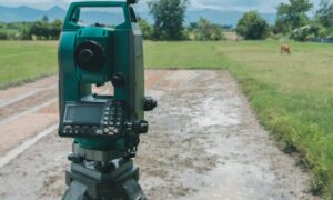
Welcome to ALTA Survey Tennessee

Your Final Stop for Your ALTA Survey Needs!                              Contact us today for a free quote!

This site is intended to provide you with information on ALTA Surveying in Tennessee. If you’re looking for a Tennessee Land Surveyor, you’ve come to the right place. If you’d rather talk to someone about your land surveying needs, please call our toll-free number at (888) 808-9783 today. For more information, please continue to read.

ALTA Survey Tennessee

Land Surveyors are professionals who make precise measurements to determine the size and boundaries of a piece of real estate.  While this is a simplistic definition, boundary surveying is one of the most common types of surveying related to home and land owners. If you fall into the following categories, please click on the appropriate link for more information on that subject:

ALTA Survey Tennessee services:

    1. I need to know where my property corners or property lines are. (Boundary Survey)
    2. I have a loan closing or re-finance coming up on my commercial property. (ALTA Survey)
    3. I need a map of my property with contour lines to show elevation differences for my architect or engineer. (Topo Survey – ALTA Survey plus Table A Item 5.)
    4. I’ve just been told I’m in a flood zone or I’ve been told I need an elevation certificate in order to obtain flood insurance or prove I don’t need it. (Flood Survey)
    5. I’m purchasing a lot/property for a commercial use. (ALTA Survey – Item 5 and/or Item 11b may also need to be discussed.)
    6. I’m purchasing a larger tract of land, acreage, that hasn’t been subdivided in the past. (Boundary Survey)

author avatar
Surveyor

More Posts

Drone LiDAR for Construction in Nashville TN: A Game Changer

Nashville’s skyline is transforming fast—and behind the scenes, construction companies are quietly adopting powerful tools to keep up. One of the most impactful is drone-based LiDAR, a surveying solution that’s changing the game for builders across Middle Tennessee. Once reserved for large engineering firms, this advanced mapping solution is now

Read More »

LiDAR Mapping Drives Chattanooga’s Urban Growth in 2025

LiDAR mapping is helping Chattanooga, TN grow into one of the most modern cities in the Southeast. Known for its beautiful scenery and creative energy, the city is now leading the way in smart urban development. In 2025, new projects are changing neighborhoods across Chattanooga—and LiDAR is playing a big

Read More »

Essential Guide to Structural Engineering in Residential Design

Behind every great-looking home is a structure designed to hold it all together. Structural engineering in residential design makes sure your dream home isn’t just beautiful—it’s also strong, safe, and built to last. Structural engineering is all about planning the “skeleton” of a house. It takes things like gravity, wind,

Read More »

Drone LiDAR Mapping in Nashville

Technology is advancing rapidly, and one of the biggest breakthroughs in mapping and surveying is LiDAR (Light Detection and Ranging). This advanced technology uses laser pulses to create detailed 3D models of the Earth’s surface. Now, with the use of drones, LiDAR mapping has become faster, more accurate, and more

Read More »

How to Find Out If There Are Easements on Your Property

If you’re buying, selling, or making changes to your property, you might want to check if there are any easements attached to it. An easement is a legal right that allows someone else—like a neighbor, utility company, or even the government—to use a portion of your land for a specific

Read More »