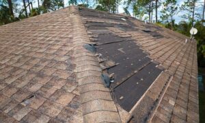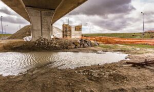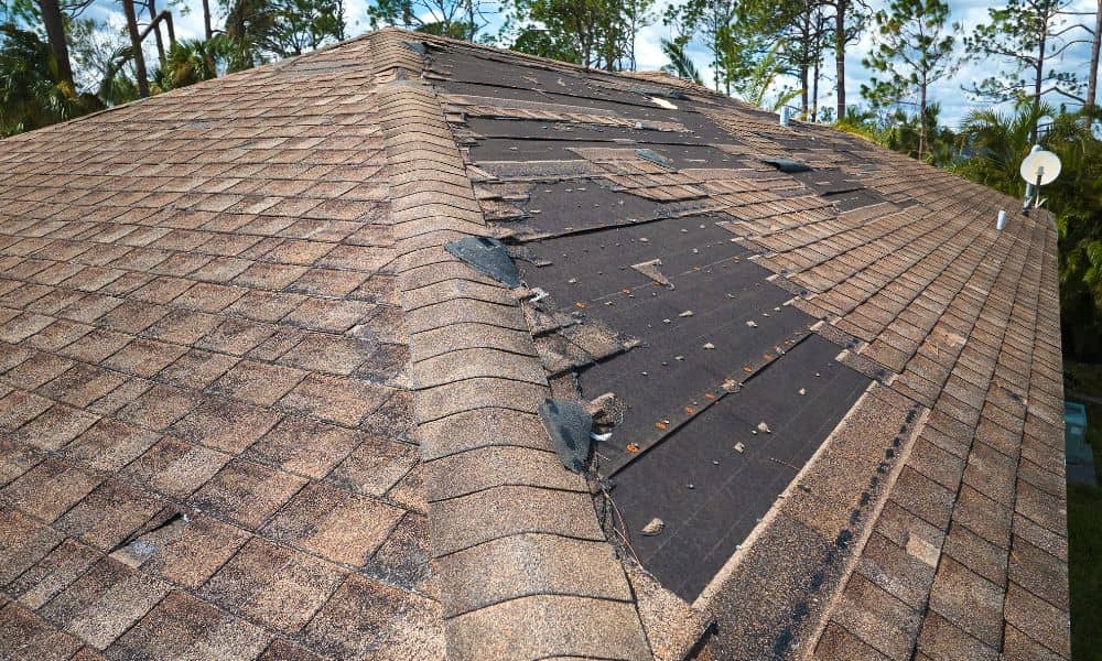
When massive storms hit Clarksville, the damage shocks everyone. Fallen trees crush fences. Roof shingles scatter across the yard. Water pools where the ground dips. Weeks later, homeowners still discover new problems. This is why more people now ask surveyors about using a drone survey after a major storm. The idea feels strange at first, but it is quickly becoming normal across Tennessee. With stronger weather systems hitting more often, families want faster answers, clearer visuals, and proof of storm damage they can trust.
Storms used to leave obvious destruction. Today, the damage hides behind trees, on rooftops, or deep in the backyard. Many neighborhoods have heavy tree cover, narrow lots, and aging roofs. A storm can hurt a home without any clear signs from the street. Homeowners walk around and think everything looks fine, only to find major issues later. Because of this, people are turning toward new tools to get ahead of the problem.
Why Storms Changed Everything for Homeowners
A storm does not need to rip a roof apart to create long-term problems. Sometimes, the trouble grows slowly. Shingles loosen. Water seeps under flashing. Soil shifts near the foundation. The homeowner does not notice until damage becomes expensive. Sadly, by then it is late.
Insurance companies expect proof. They want visible evidence the storm caused the damage. When that proof is missing, claims become stressful. A drone survey changes that. It documents damage early, while everything is still fresh, clear, and verifiable.
Because drones capture images from angles no human can reach, they show the storm’s real effect. This gives homeowners confidence. It also helps insurers process claims with clarity instead of doubt.
What a Drone Survey Shows That Homeowners Can’t See
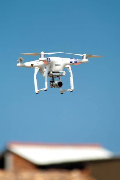
A drone can fly above trees, fences, and roofs without risk. It shows:
- missing shingles
- roof punctures
- gutter damage
- hidden standing water
- branches trapped behind the home
- erosion forming near slopes
- fence leaning at the base
It gives more than photographs. It gives perspective. Homes look very different from the air. From the ground, it is easy to miss harm. From above, the story becomes obvious. And when homeowners can see the truth, smart decisions follow naturally.
How Drone Surveys Create Faster Insurance Results
Timing matters more than anything after a storm.
Insurance adjusters need proof before approving repairs. Yet storms overwhelm everyone. Inspectors get behind. Contractors get booked up. Days pass. Then weeks. Conditions change.
That delay hurts the homeowner.
A drone survey freezes the original damage in time. So, when the adjuster finally arrives, there is no doubt what happened. This saves: time, money, stress and arguments.
It gives homeowners leverage during the claim process instead of uncertainty.
Why Clarksville’s Fast Growth Makes Damage Harder to Spot
Clarksville is expanding in every direction. New subdivisions rise near Sango, Oak Grove, St. Bethlehem, Tiny Town Road, and Fort Campbell.
These developments have:
- tighter lot lines
- more trees near homes
- more fences
- drainage channels running behind houses
That means a storm hits more of the property at once. Yet walking the entire site is impossible for homeowners. Drone surveys make the entire property visible in minutes. No guesswork. No worrying. Just clarity.
The Hidden Costs of Waiting Too Long
Many homeowners wait until they notice problems.
But storms cause delayed damage.
The smallest crack today creates mold next month.
A crooked gutter today becomes foundation erosion next year.
Waiting is expensive.
Drone surveys expose issues while still manageable.
Catching problems at the start saves thousands later.
Should You Use a Drone Survey Before a Storm Hits?
More homeowners are doing this. And it makes sense.
A pre-storm drone survey creates a visual baseline. Then when a storm strikes, the “before and after” comparison is crystal clear.
No debates.No confusion. No stress. Insurers prefer documented timelines. Homeowners benefit from better protection. And every contractor appreciates accurate visuals.
It’s Not Replacing Traditional Surveys — It Complements Them
A drone survey does not replace a traditional land survey.
It does not define boundaries. It does not determine property lines. It does not resolve neighbor disputes.
Instead, it focuses on: damage condition visual documentation Think of it as a tool that fills the gap between storm and recovery.
What This Shift Means for Clarksville Families
Storms are getting louder and stronger. Homes are feeling the strain.
And residents want to stay ahead. Drone surveys give families: peace of mind, faster documentation, better evidence, and clearer decisions. That is why this trend is rising fast.
Final Takeaway
The next storm will arrive. No one knows when. No one knows how strong.
But homeowners can prepare.
Understanding the damage early matters. Documenting it matters. Protecting your investment matters.
A drone survey gives families a powerful advantage during stressful moments. And when the next storm hits, you will be glad you did not wait.
