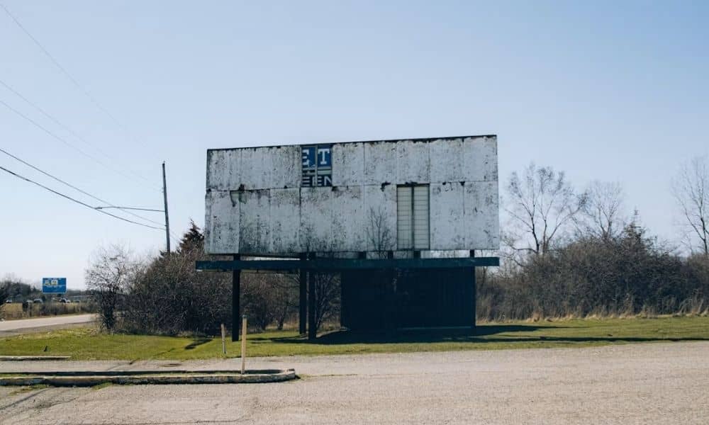
A commercial parcel might carry a billboard or pole sign that sits on a small patch of ground near the road. That patch can be tied to its own lease, with rights that belong to a party other than the property owner. For a commercial deal, that small area can raise questions worth sorting out before closing.
This is where survey planning gets specific. The sign you see is one thing. The area described in the lease is another. Buyers, lenders, and title professionals often need to know how those two things line up on the actual property.
Why a Sign Lease Can Matter Beyond the Sign Structure
A sign lease can create a land-use question that is separate from the rest of the property. The owner may collect rent from a sign company for the right to keep a structure on part of the site. That right can run with the land and pass to a new owner after a sale.
The visible sign and the leased area are not always the same. A lease might describe a rectangle of ground, an access path, and a zone of air space above it. The pole itself may cover only a few square feet inside that larger described area. So the sign a buyer looks at may be smaller than the ground rights written into the lease.
For a commercial transaction, that gap matters. A buyer taking the title wants to know where the leased area sits on the parcel they are purchasing. Title professionals reviewing the deal want the same clarity, because the lease may affect how the property can be used or built on later.
Where the Leased Sign Area Meets the Surveyed Property
A survey can show the physical sign and, when documents support it, the location of the leased area on the parcel. What the surveyor depicts depends on what can be seen on the ground and what the documents allow to be plotted. The two together give a clearer read than either one alone.
Here is what a surveyor can typically address:
- The location of the sign structure and related visible items, such as the pole base, footings, or a service panel
- How that structure sits in relation to the property boundary
- How it relates to other surveyed features like driveways, utilities, or parking
- Whether the lease or an attached exhibit gives a described area that can be placed on the drawing
That last point is the key one. If the leased area itself needs to be shown, the surveyor needs the lease or exhibit that describes it. A sign being visible does not tell the surveyor where the leased boundary runs. The written description does.
A survey shows physical and document-based facts. It does not decide what a lease legally means. ALTA/NSPS standards deal with matters disclosed through title evidence and other documents given to or obtained by the surveyor. The surveyor plots what those documents describe. A lawyer reads what those documents require.
The Lease Exhibit Can Tell a Different Story From the Ground
Sometimes the paper and the ground do not match. A lease exhibit might show a neat rectangle with dimensions. The real sign might sit a few feet off from that described spot. This turns up more than people expect, especially with older signs.
A few situations come up often:
- The lease uses dimensions or a rough sketch, and the sign was later placed somewhere close but not exact
- The described area covers a portion of the parcel that is hard to spot on the ground
- Site conditions changed after the lease was signed, so pavement, grading, or fencing no longer match the exhibit
- The structure appears to sit near, but not fully inside, the area the lease describes
When the survey shows both the described area and the actual structure, that difference becomes visible. The drawing can flag it. What the drawing will not do is settle it. The surveyor’s role is to survey and depict what the scope and evidence allow. Deciding which party holds the stronger right, or whether the sign crosses a line, falls to the legal and title team.
Table A Planning for a Commercial Site With Signage Rights
Good results start with scope. Tell the surveyor about the sign lease at the start of the project, not after the fieldwork is done. Early notice lets the survey scope match the real needs of the deal.
A few steps help:
- Share the relevant lease, exhibit, amendment, or recorded document as soon as it is available
- Say clearly whether you need the sign structure shown, the leased area shown, or both
- Coordinate scope with the title company and the transaction team so everyone expects the same drawing
- Ask whether any added Table A items fit this particular property and transaction
The 2021 ALTA/NSPS standards allow for added survey responsibilities and the depiction of certain matters disclosed by documents. That is why early coordination pays off. If the surveyor learns about the lease at the right time, the scope can be set to cover it.
An ALTA title survey does not automatically map every term or dimension in a private sign lease. Whether an item can be shown depends on the agreed scope, the documents provided, and whether the matter can actually be plotted. A vague sketch may not translate cleanly to a surveyed line.
A Small Sign Area Can Carry Big Deal Questions
A leased area might cover a tiny slice of a large commercial site, yet still shape due diligence. Its size does not decide its weight. A billboard lease can carry income, term length, renewal rights, and use limits that a buyer will inherit.
Showing the sign area on the survey helps the transaction team see the physical picture. They can compare where the sign sits against what the lease describes and what the title work shows. That comparison is easier when the pieces are in one drawing.
Buyers should hand the surveyor the sign-lease documents rather than assume the surveyor already has them. The surveyor usually receives title evidence, but a private lease may not be part of that package. If you want the leased area addressed, the document needs to reach the field team.
For commercial property teams, the practical move is to coordinate survey, title, and lease information early. An ALTA title survey is one source of physical and document-based facts. It does not clear a sign lease or promise that a deal will close. It gives the professionals working the transaction a clearer view of the ground.
Frequently Asked Questions
Can an ALTA title survey show the location of a leased sign area?
It can, if the area can be identified and depicted within the survey scope and the supporting documents. The surveyor needs the relevant lease or exhibit when the leased area itself must be evaluated. A visible sign alone does not tell the surveyor where the leased boundary runs. Share the description early so the scope can include it.
Does a sign lease automatically appear on an ALTA title survey?
No. The surveyor works from title evidence and other documents provided or obtained during the assignment, along with the agreed scope. A private lease should not be assumed to appear just because a sign stands on the property. If you want it addressed, give the surveyor a copy before fieldwork begins.
What if the billboard is outside the area described in the sign lease?
That becomes a question for the legal and title professionals on the deal. The survey can document the physical conditions within its scope, including where the structure sits and where the described area falls. A surveyor does not ordinarily decide the legal meaning or enforceability of a lease. The drawing shows the facts, and the legal team reads them.