Technology is advancing rapidly, and one of the biggest breakthroughs in mapping and surveying is LiDAR (Light Detection and Ranging). This advanced technology uses laser pulses to create detailed 3D models of the Earth’s surface. Now, with the use of drones, LiDAR mapping has become faster, more accurate, and more affordable than ever before.
Nashville, Tennessee, is a fast-growing city that is benefiting greatly from drone LiDAR mapping. This technology is helping city planners, environmentalists, and engineers collect and analyze geographic data more efficiently.
📈 The Growth of Drone LiDAR Mapping in Tennessee
Tennessee has used LiDAR technology for years, but drone-based LiDAR has made mapping and surveying faster and more accurate. As Nashville grows, precise maps are needed for new roads, buildings, and infrastructure. LiDAR drones help surveyors, engineers, and city planners collect data quickly and affordably.
A big step forward was the Tennessee LiDAR Program, completed in 2021, which provided detailed maps of the entire state. Since then, many government agencies and private companies in Nashville have started using drones for LiDAR mapping.
Drones offer:
✅ Faster surveys compared to traditional land-based methods
✅ Lower costs than airplane-mounted LiDAR
✅ Improved access to difficult-to-reach areas (forests, mountains, and urban landscapes)
As demand for accurate and real-time data increases, drone-based LiDAR is becoming the preferred method for surveying in Tennessee.
🔹 Why Drone LiDAR Mapping is Better Than Traditional Methods
| Feature | Drone-Based LiDAR | Traditional Aerial LiDAR |
| Cost | More affordable | Expensive (requires airplanes) |
| Accuracy | High resolution for small areas | Better for large-scale mapping |
| Speed | Quick deployment, fast results | Slower and weather-dependent |
| Accessibility | Can survey forests, mountains, and urban areas | Limited to open spaces |
🚀 Key Advantages
✅ Cost-Effective – No need for expensive aircraft or long fieldwork hours
✅ High Resolution – Provides more detailed data than satellite or aerial LiDAR
✅ Faster Deployment – Drones can be launched quickly, reducing project delays
✅ Access to Hard-to-Reach Areas – Ideal for surveying forests, floodplains, and densely built environments
🏗️ Applications of Drone-Based LiDAR in Nashville
🏙️ Urban Development & Smart City Planning
Nashville is growing rapidly, and city planners require accurate 3D models to design new roads, buildings, and public infrastructure. Drone LiDAR helps create detailed maps that ensure proper zoning, land use, and sustainable development.
🏗️ Construction & Land Surveying
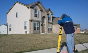
Before construction begins, accurate topographic surveys are crucial. LiDAR drones help engineers and architects:
- Identify elevation changes
- Map land contours
- Avoid costly construction mistakes
With drone-based LiDAR, land surveys that once took weeks can now be completed in hours.
🌱 Environmental & Conservation Efforts
Tennessee is home to vast forests, rivers, and protected lands. LiDAR is used to:
- Monitor deforestation and wildlife habitats
- Map flood-prone areas to improve disaster planning
- Track erosion and water levels in rivers and lakes
Government agencies like the Tennessee Department of Environment & Conservation rely on drone-based LiDAR for these critical environmental assessments.
🏛️ Historical Preservation & Archaeology
Nashville and surrounding areas have historical sites and Civil War battlefields that need preservation. LiDAR drones can:
- Reveal hidden structures buried under vegetation
- Identify ancient trails and foundations
- Help archaeologists document historic landscapes
🔮 The Future of Drone-Based LiDAR in Nashville
As technology evolves, drone-based LiDAR is set to become even more advanced. Future innovations include:
🚀 AI & Machine Learning – Automating data processing for faster analysis
📡 5G Connectivity – Enabling real-time LiDAR data streaming
🚘 Self-Driving Cars – Using LiDAR for real-time navigation
🏙️ Smart Cities – LiDAR-powered traffic management and urban planning
Nashville’s government and private sector are expected to invest more in LiDAR for applications like:
- Disaster response and flood monitoring
- Infrastructure maintenance and road planning
- Environmental sustainability projects
Drone LiDAR mapping is transforming Nashville’s growth, improving city planning, construction surveys, environmental protection, and historic site preservation. It makes mapping faster, cheaper, and more accurate. As technology advances, Nashville will continue using LiDAR for smarter planning.
